What’s a sight more captivating than an ever-changing sky? For most of us, different types of storm clouds are both awe-inspiring and a little bit unnerving. They’re dramatic, beautiful, and, of course, a clear sign that we might need an umbrella soon. But what can they tell us about the weather patterns around us?
Let’s take a deep dive into the world of storm clouds and see if we can decode some of their secrets.

The Thunderous Cumulonimbus: The Giant of Storm Clouds
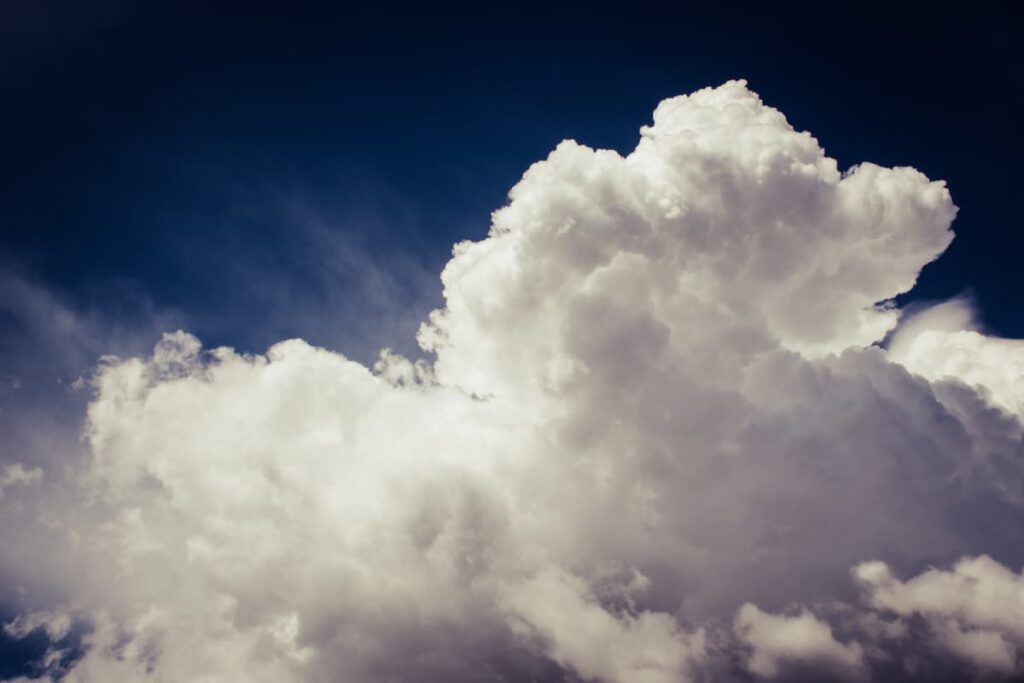
If storm clouds were a kingdom, the Cumulonimbus would be the reigning monarch. These clouds are the largest and most dangerous of all storm clouds. They are often characterized by their impressive height, sometimes reaching up to 60,000 feet, and are usually accompanied by thunderstorms, heavy rain, and even tornadoes.

Imagine you’re standing on a beach, gazing at the horizon. The sky darkens as this colossal cloud formation approaches. Lightning streaks across the sky, followed by the deep rumble of thunder. That’s the mighty Cumulonimbus cloud for you.
Nimbostratus: The Constant Drizzle
If you’ve ever experienced a day where the rain just won’t let up, you’ve likely seen a Nimbostratus cloud. These storm clouds are lower in the sky and spread out across a large area, often covering the entire sky. They don’t bring the violent weather associated with Cumulonimbus clouds, but they do bring consistent, usually light to moderate, precipitation that can last for several hours, or even days.

Picture a day where you’re cooped up inside, a book in hand, listening to the continuous patter of rain against your window. That’s the work of Nimbostratus clouds.
A Deeper Look into Storm Clouds
| Storm Cloud Type | Characteristics | Weather Associated |
|---|---|---|
| Cumulonimbus | Towering and impressive, can reach up to 60,000 feet | Thunderstorms, heavy rain, lightning, hail, and possibly tornadoes |
| Nimbostratus | Low, wide clouds often covering the entire sky | Continuous, typically lighter rain or snow lasting for hours or days |
| Mammatus | Unique, pouch-like structures hanging from the sky | Can be an indicator of a nearby storm, but not a threat themselves |
The Illusive Mammatus Clouds: An Ominous Beauty
Ever seen those odd, lumpy clouds that look like a field of cotton balls hanging from the sky? Those are Mammatus clouds. These storm clouds are rare and often associated with severe weather conditions, like thunderstorms and tornadoes. Despite their ominous appearance, Mammatus clouds don’t pose a threat on their own, but they can be a sign of a nearby storm.

Imagine you’re walking down a city street and you see people pointing at the sky, marveling at the strange, lumpy clouds. That’s the captivating sight of Mammatus clouds.
Unpredictable and Beautiful: The Science Behind Storm Clouds
Storm clouds, like all weather phenomena, are governed by complex physical processes. It’s the rise and fall of warm and cold air that creates clouds, and the specific conditions that determine whether those clouds will become storm clouds.
What’s more, each type of storm cloud is unique. They form under different conditions, bring different types of weather, and even look distinctly different. Understanding these storm clouds can provide valuable insight into our weather and climate. So, the next time you see a storm brewing, take a moment to observe the clouds. You might just be able to predict the weather that’s coming your way!
Storm Clouds and Climate Change: A Rapidly Changing Sky
In our ever-changing world, climate change is affecting many aspects of our lives, including our weather patterns and, consequently, our storm clouds. Researchers have found that warmer temperatures and increased moisture in the atmosphere can lead to more intense storm cloud formations. This can result in more extreme weather events, like heavier rainfall and more frequent and severe storms.
Consider this: You’re noticing that thunderstorms in your hometown are becoming more frequent, and when they do occur, they seem more severe than you remember as a child. This could potentially be a sign of changing climate conditions.
Decoding Storm Clouds: The Tools of the Trade
Meteorologists use a variety of tools to study and predict weather patterns, including storm clouds. Radar technology allows them to see the internal structure of storm clouds and predict severe weather events. Satellites provide a broader view of cloud patterns and movements over the Earth’s surface.
Imagine a meteorologist at their desk, studying the colorful radar images on their computer screen. They notice a formation of Cumulonimbus clouds moving towards a city. They immediately issue a severe weather warning, helping the city prepare for the upcoming storm.
The Art of Remembering: Tricks to Memorize the Names of Storm Clouds
Remembering the names of different types of storm clouds might seem like a daunting task, but fear not! Here are a few mnemonic tricks and tips to make this process easier and even fun.
Cumulonimbus: The Sky-scraping King
Let’s start with the Cumulonimbus. Cumulonimbus clouds are the tallest and most dramatic of storm clouds, often resulting in heavy rain, thunderstorms, and even tornadoes. A helpful way to remember this is to think of a ‘Cumulative Nimbus,’ as these clouds pile up, or accumulate, to great heights. ‘Nimbus,’ in Latin, means ‘rain’ – so you’re thinking of ‘accumulating rain’ – a pretty apt description of these towering clouds!
Nimbostratus: The Persistent Rain-bringer
Next up is the Nimbostratus, a cloud associated with steady, persistent rain or snowfall. These are broad, thick, and gray clouds covering the sky, leading to overcast conditions. To remember this, you might think of ‘nimble stratus.’ While these clouds aren’t exactly nimble, the phrase can remind you that these are the stratus clouds that aren’t just hanging out – they’re nimble, they’re doing something, i.e., bringing continuous rain or snow.
Mammatus: The Cotton Ball-like Cloud
Finally, let’s move on to the rare and beautiful Mammatus clouds. These clouds look like a field of cotton balls or pouch-like structures hanging from the sky. The term ‘Mammatus’ comes from the Latin word ‘mamma,’ meaning ‘udder’ or ‘breast,’ referencing their rounded, sagging appearance. To remember this name, think of ‘mammary’ or ‘mammal,’ which will remind you of the similarly rounded shapes that these clouds form.
Engage with the Clouds Around You
Remembering these names will be much easier if you actually use them. When you see storm clouds, try to identify them and say their names out loud. Discuss the clouds with friends or family, or even start a weather journal where you record and describe the clouds you see each day.
Name That Cloud!
Remembering the names of different types of storm clouds doesn’t have to be hard. With these mnemonic devices, a little practice, and an observant eye, you’ll soon be able to name those clouds like a pro. Not only will this enhance your understanding of the weather, but it will also give you a new way to appreciate and interact with the natural world around you. So, the next time you spot those intriguing formations in the sky, you’ll know exactly what you’re looking at. Happy cloud-watching!
Conclusion: Embracing the Storm
Clouds are more than just fluffy shapes floating aimlessly in the sky. They are intricate parts of our planet’s weather system, especially storm clouds, which can tell us a lot about the upcoming weather. Whether it’s the towering and formidable Cumulonimbus, the persistent Nimbostratus, or the eerie beauty of Mammatus clouds, each type is fascinating in its own right.
Storm clouds, despite their often threatening presence, are a vital part of our planet’s weather system. Understanding different types of storm clouds is more than just an interesting hobby; it’s a tool that can help us predict the weather, prepare for storms, and better understand our changing climate.
So, the next time you see those dramatic clouds gathering in the sky, take a moment to appreciate their power and beauty. After all, they’re not just delivering our weather—they’re also telling the story of our planet’s atmosphere.
- Comprehensive Guide to Hold Cleaning for Cargo Ships: Ensuring Maritime Safety and Efficiency – October 19, 2024
- Responsibilities of a Fourth Engineer on Cargo Ships – September 10, 2024
- The Role of Cargo Ships in Global Trade – August 22, 2024


