MarineTraffic is a household name in global vessel tracking, renowned for its extensive database and detailed maritime analytics.
However, it’s not without its limitations for free users, giving limited ship particulars and voyage details and even locking basic tools on the charts.
VesselFinder, on the other hand, fills some of these gaps, offering unique features that cater to specific maritime tracking needs.
But, like any service, VesselFinder isn’t flawless either, facing its own set of challenges and limitations.
So, which platform should you choose for your maritime vessel tracking needs?
⏰ TL;DR: MarineTraffic vs VesselFinder
- MarineTraffic has better-detailed data and analytics with wide coverage in paid plans, ideal for in-depth maritime research.
- VesselFinder offers more vessel details in a free plan, simplicity, cost efficiency, and accurate real-time tracking, suited for budget-conscious users needing quick updates.
- Choose MarineTraffic for comprehensive insights and VesselFinder for affordability and ease of use.
MarineTraffic vs VesselFinder: A Quick Overview
MarineTraffic and VesselFinder are two leading services in ship tracking, offering real-time data on vessel movements worldwide.
MarineTraffic is known for its comprehensive database and advanced maritime analytics, catering to users needing detailed information.
VesselFinder, contrastingly, focuses on simplicity, affordability, and accurate real-time tracking, appealing to those seeking quick updates without the need for in-depth analysis.
Both platforms serve the maritime community, but they cater to different user needs based on the depth of data, user interface, and subscription models.
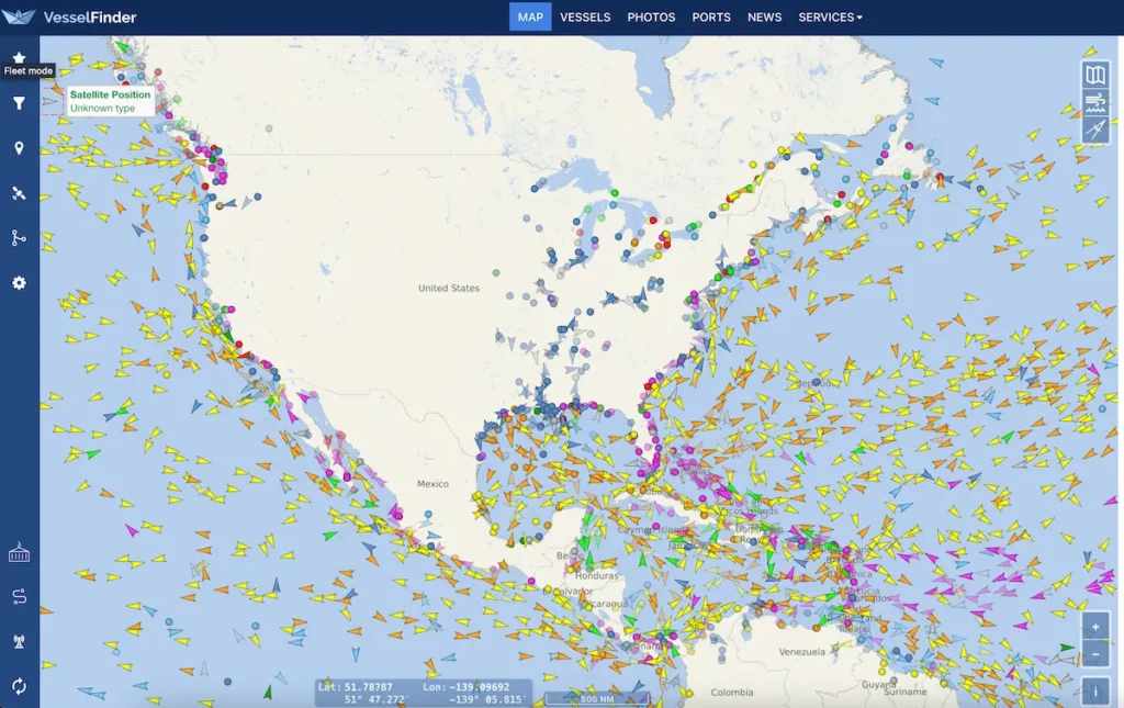
How MarineTraffic and VesselFinder Operate
MarineTraffic and VesselFinder utilize Automatic Identification System (AIS) technology to track vessels worldwide. AIS is a maritime navigation safety communications system, mandatory on all large ships, that transmits data such as location, speed, and course, among other details.
Satellite-AIS is used to cover areas outside the terrestrial range of AIS both by VesselFinder and MarineTraffic. Satellite-AIS is accessible only by users with paid plans.
Exploring the Technology Behind the Tracking
AIS works by vessels and shore-based stations exchanging data via VHF radio frequencies. Vessel tracking services collect this data from a network of AIS receivers located around the globe. The information is then processed and presented on their platforms, offering users real-time and historical data on ship movements.
Satellite-AIS enhances tracking by utilizing satellites to collect data on vessels located beyond the reach of terrestrial AIS networks. This technology allows for global coverage, ensuring vessels in remote areas can be monitored. Available to users with paid plans, Satellite-AIS ensures continuous tracking capabilities, filling gaps in coverage where terrestrial signals cannot reach.
These technologies enable both services to provide detailed maritime tracking, although their coverage, accuracy, and additional features may vary.
MarineTraffic and VesselFinder free accounts provide basic vessel and voyage details, including ship name, type, position, and destination. Here is a comparison table of the information available for free accounts.
| Feature | MarineTraffic | VesselFinder |
|---|---|---|
| Vessel name | YES | YES |
| Vessel Type | YES | YES |
| Flag | YES | YES |
| Homeport | NO | NO |
| IMO/MMSI/Call Sign | YES | YES |
| Current Position on Map | YES | YES |
| Latitude/Longitude | YES | NO |
| Course/Speed | YES | YES |
| Current draught | YES | YES |
| Destination | YES | YES |
| ETA (AIS data) | YES | YES |
| Length/Beam | YES | YES |
| Gross Tonnage | – | YES |
| Summer Deadweight | – | YES |
| Year of Build | – | YES |
| Recent Port Calls | – | YES (5) |
| Previous Names | – | YES |
| Vessel photo | YES | YES |
Both MarineTraffic and VesselFinder offer a feature that provides the past 24 hours of vessel tracking, complete with speed visualization. This functionality allows users to see the vessel’s movements and speed variations over the last day.
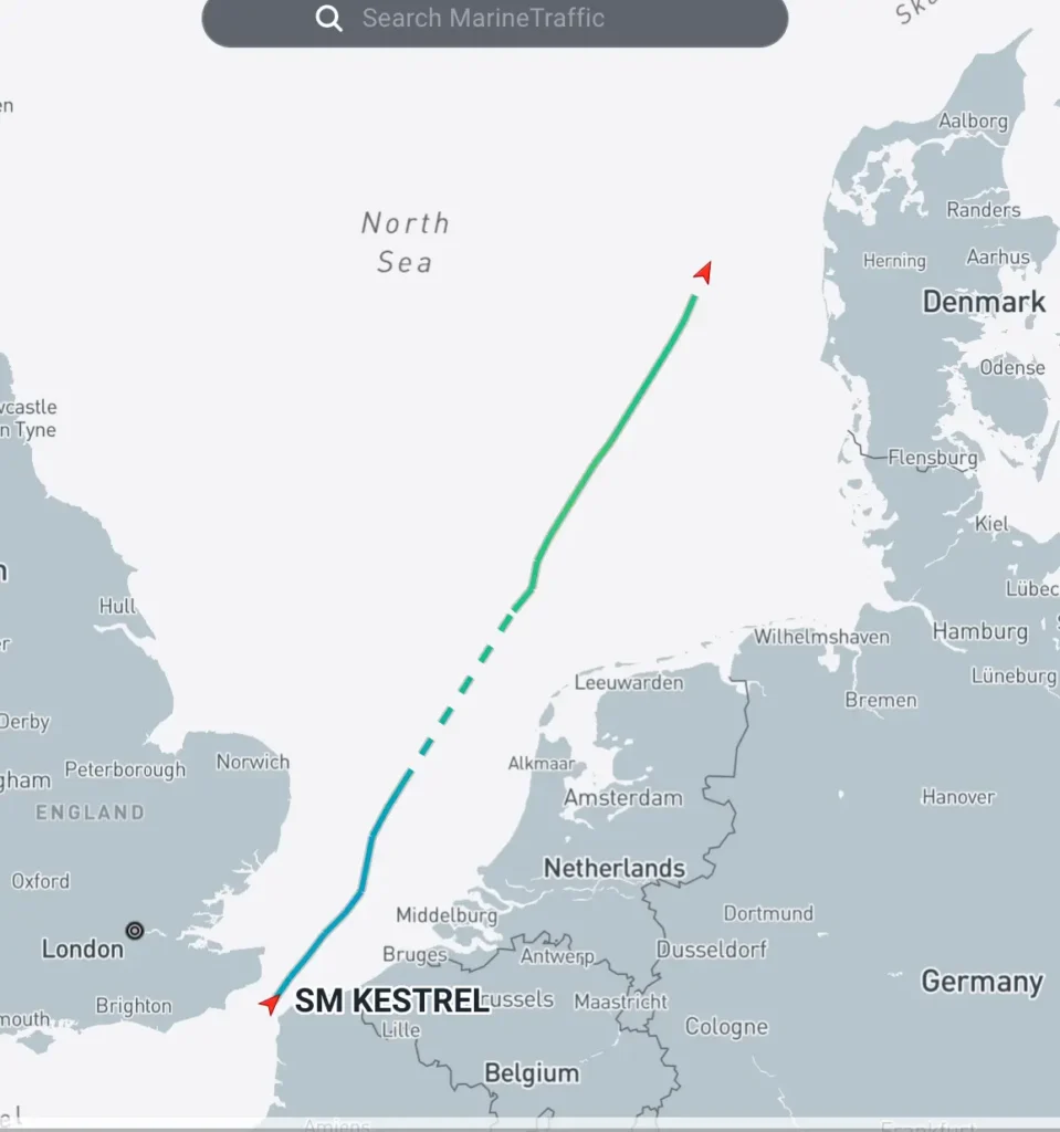
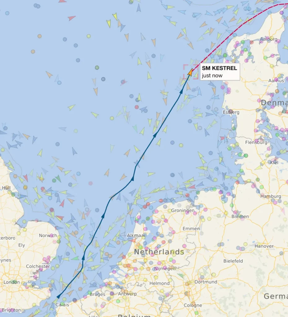
Additionally, both services offer track prediction capabilities based on the vessel’s destination as obtained from the Automatic Identification System (AIS). This predictive feature helps in estimating the vessel’s future course and arrival time at its destination, enhancing the understanding of its navigational pattern and schedule.
Maps And Vessels Visual Appearance
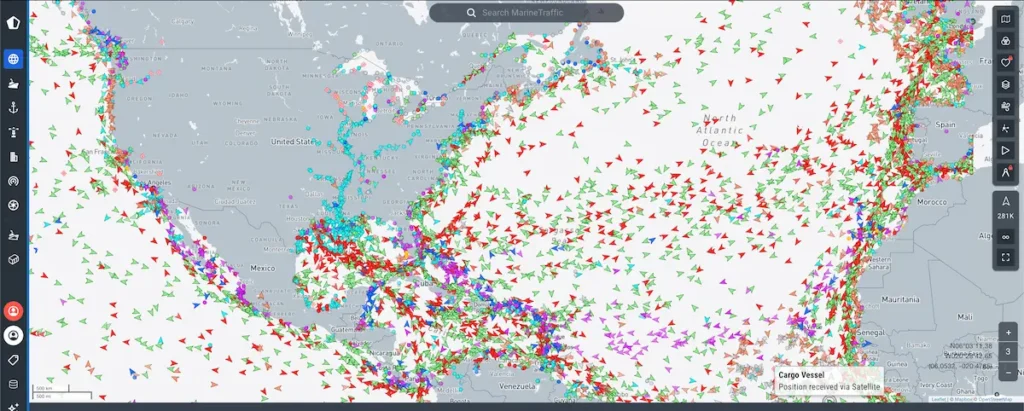
The visual appearance of vessel tracking services like MarineTraffic and VesselFinder is designed to offer a user-friendly interface that provides detailed information about ships and their movements across the globe.
Vessel tracking services can be navigated through the search of ships by name, IMO, or MMSI numbers. The ship detail page will then show all ship particulars and voyage details.
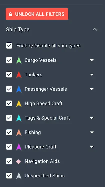
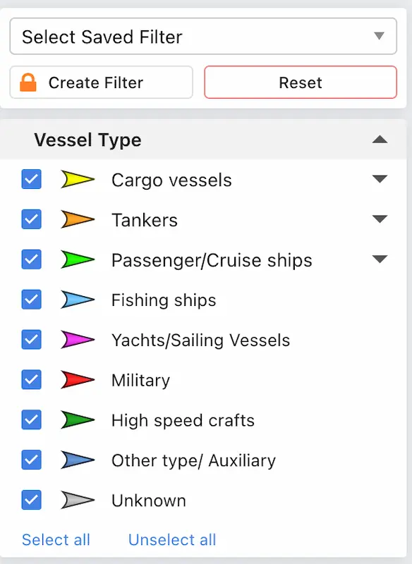
Live maps display all ships in the selected area. Visual appearance on the maps is color-coded for better user experiences. MarineTraffic and VesselFinder use different color codes and symbols on the map. Regular users get used to particular color-coded visualization which makes it harder to switch between platforms.
MarineTraffic was my first choice for many years and I got very used to it. During recent years, MarineTraffic reduced the free accessible information, which made me a dual user of both services. Now I meet colleagues who prefer VesselFinder due to more detailed vessel data or to strong habits to appearance.
Here’s an overview of their visual features, including color coding for different types of ships and the maps used:
MarineTraffic and VesselFinder Mobile Apps
The MarineTraffic app is the most popular vessel tracking app. The mobile app is serving more than 300,000 vessels each day.
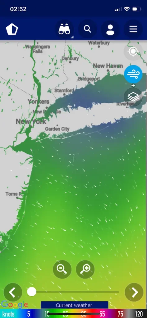
It offers a wide array of features, including real-time maps, wind forecasts, information on port arrivals and departures, and an extensive photo gallery. A standout feature is its augmented reality capability for easy vessel identification and sophisticated route planning options.
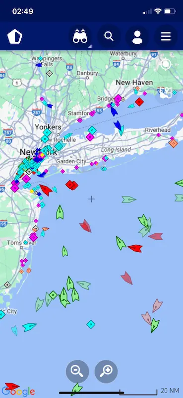
VesselFinder Lite, while also providing real-time ship tracking and details for over 200,000 ships, emphasizes ease of use with features like ship and port search, ship movement history, and a variety of map views. It offers a free version with basic functionalities and a Pro version for an ad-free experience and extended tracking history.
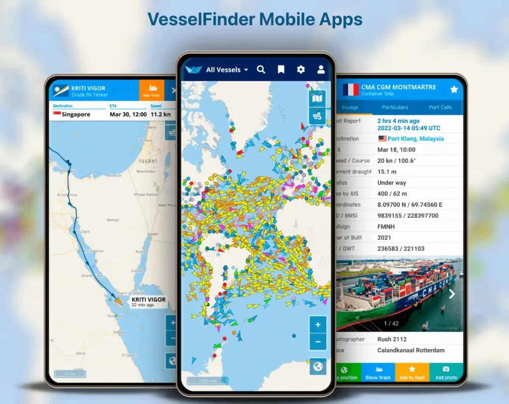
Comparatively, MarineTraffic’s popularity may stem from its wider array of features and larger vessel database, appealing to users needing comprehensive maritime information. VesselFinder Lite offers a solid, user-friendly alternative for those prioritizing essential tracking functions without cost.
What VesselFinder and MarineTraffic Offer in Paid Accounts?
MarineTraffic Paid Plans
- Standard Plan: Starts at $19 per month (billed yearly), offering essential features for vessel tracking.
- Professional Plan: Priced at $69 per month (billed yearly), it provides advanced vessel tracking capabilities for a single vessel.
- Professional Plus Plan: At $129 per month (billed yearly), this plan supports comprehensive tracking for up to 10 vessels.
- Global Satellite Plan: An enterprise solution for unlimited global vessel tracking, pricing is provided upon contact.
- Add-ons: Include Satellite AIS tracking for additional vessels, extra data export records, grouping and monitoring of vessels (Fleet 50, Fleet 500), additional notification credits, and full access to voyage planner features.
VesselFinder Paid Plans
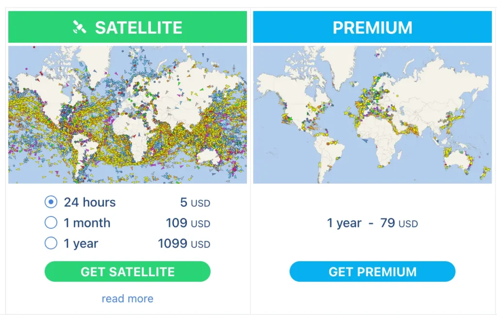
- Premium Plan: Costs $79 for one year, offering features like unlimited satellite coverage, terrestrial coverage, 7 days of track history, support for up to 500 ships in “My Fleet”, 5 port calls, 100 route planner uses, and more.
- Satellite Plan: Offers 24-hour access for $5, one month for $109, and one year for $1099, including unlimited satellite coverage, 30 days of track history, support for 1000 ships in “My Fleet”, unlimited route planner, and additional features like container tracking and advanced vessel filters.
Paid Key Features Comparison
- Track History: MarineTraffic plans do not specify the length of track history in the brief overview, whereas VesselFinder offers up to 30 days of track history in its Satellite plan and 7 days in the Premium plan.
- Fleet Management: MarineTraffic allows for comprehensive fleet management with its Professional Plus and add-on options, while VesselFinder’s Premium plan supports up to 500 ships in “My Fleet”.
- Route Planning: Both services offer route planning capabilities, with MarineTraffic providing this feature as an add-on and VesselFinder including it in its plans.
- Satellite Coverage: Both platforms offer satellite AIS tracking, with VesselFinder emphasizing unlimited satellite coverage in its plans.
- Additional Features: Both services include vessel particulars, satellite maps, nautical charts, and no ads. VesselFinder’s plans also highlight features like container tracking and advanced filters.
Visual and Usability Aspects
Both MarineTraffic and VesselFinder maintain a similar appearance and functionality across their desktop and mobile versions, ensuring a seamless user experience. MarineTraffic’s weather map feature is particularly useful for estimating ship voyages, providing users with valuable insights into potential weather impacts on sailing schedules.
This comparison highlights the diverse range of features and functionalities offered by MarineTraffic and VesselFinder, catering to various needs from basic tracking to comprehensive fleet management and advanced analytical tools.
- Types of Gas Carriers as per IGC Code – April 22, 2025
- Wind-Assisted Propulsion Systems (WAPS): A Game Changer for Maritime Decarbonization – February 6, 2025
- 10 Boat Salvage Yards in California – January 25, 2025

