Modern merchant ships are equipped with a dazzling array of advanced navigation systems on their navigational bridge, ensuring safe and smooth maritime journeys. Each piece of equipment plays a vital role in providing accurate voyage data.
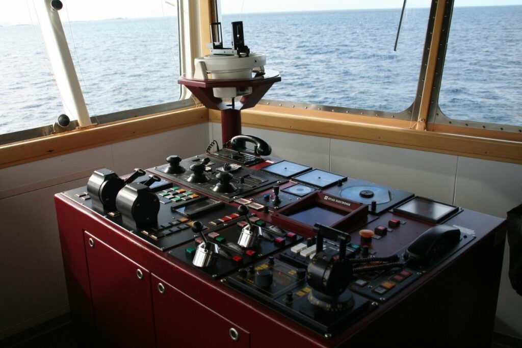
Today’s sailors are highly trained to operate these sophisticated tools, making their sea voyages not only safer but also more enjoyable. Without these essential systems, navigating the vast oceans would be a daunting and perilous task.
Gyro Compass
The Gyro Compass is a vital navigation tool used to find the true north direction, unaffected by external magnetic fields. Unlike the magnetic compass, the Gyro Compass determines the north position based on the Earth’s axis of rotation.
This provides a stable directional source, essential for accurate navigation. Its repeater system is typically installed on the steering platform, ensuring reliable maneuvering in port and during emergency steering.
Radar
Marine vessels rely on S-band and X-band radar systems for navigation. These radar systems detect and display information on the screen, such as the distance to the ground, floating objects, other vessels, and potential obstacles.
The rotating antenna scans the surrounding area, aiding in collision avoidance and helping the crew navigate safely and accurately.
Magnetic Compass
The magnetic compass operates in conjunction with the Earth’s magnetic field and serves as the primary direction indicator. It is essential for determining the ship’s route.
Typically installed on the ship’s centerline on Monkey Island, the magnetic compass provides readings in degrees from 0 to 360, crucial for safe navigation. The output signal from the transmitting compass is displayed on the bridge panel.
In the age of sail navigation, cardinal directions were commonly used. For a detailed explanation of boxing the compass and the 32 compass points, please refer to our other article.
Auto Pilot
The bridge is equipped with various navigation instruments and equipment, including one of the most effective aids—the Autopilot. Autopilot systems allow operators to steer the vessel in autopilot mode, enabling them to concentrate on broader aspects of the operation.
The Autopilot system is a combination of hydraulic, mechanical, and electrical components, which collectively control the ship’s steering from a remote location.
ARPA
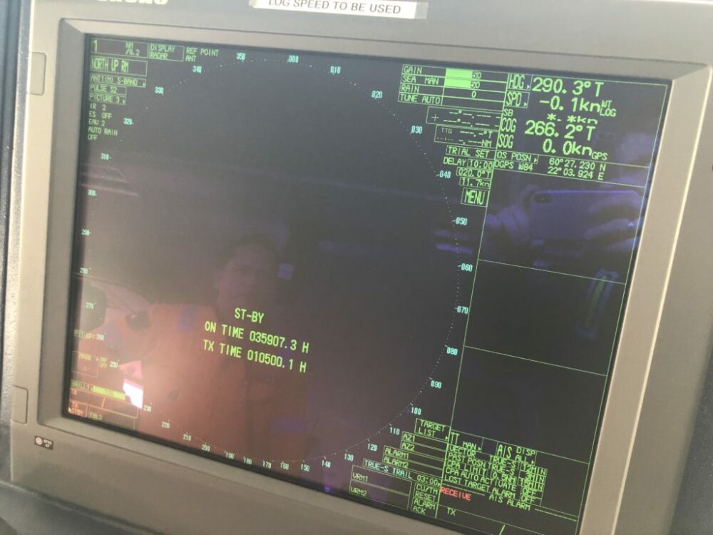
The Automatic Radar Plotting Aid (ARPA) displays the location of the ship and nearby vessels. It identifies other ships, selects an appropriate course, and helps avoid collisions.
The bridge’s navigation equipment continuously monitors the ship’s environment, identifying targets, ships, boats, and stationary or floating objects, along with their speed and course. ARPA presents this information as vectors on the display screen, updating parameters with each antenna rotation.
It calculates the closest points of approach to the ship and provides a time frame for potential collisions.
Automatic Tracking Aid
Similar to ARPA, the Automatic Tracking Aid displays information about tracked targets in both graphical and numerical form. It helps create a safer course plan that avoids collisions.
Typically, larger targets with a circumference of 800 meters or more are considered land and are not tracked. Echoes within 800 meters are treated as targets and are actively tracked.
Speed And Distance Log Device
The Speed and Distance Log Device measures both the speed and the distance a ship has traveled from a specific point. This data allows for the adjustment of the ship’s Estimated Time of Arrival (ETA), which can be communicated to port authorities and agents.
Echo Sounder
Among the various modern shipborne navigation instruments, the Echo Sounder has been a staple for nearly 100 years.
Echo Sounder measures the depth of water beneath a ship using sound waves. These sound waves bounce off the seafloor and return as echoes, allowing for accurate depth measurement.
Electronic Chart Display Information System (ECDIS)
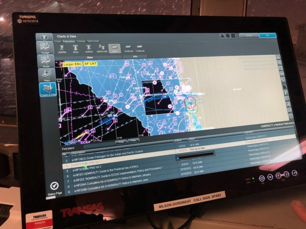
The Electronic Chart Display and Information System (ECDIS) is an advanced navigation chart system used on ships. With electronic navigation equipment, it is now much easier for the crew to determine the ship’s location and navigate efficiently.
Automatic Identification System (AIS)
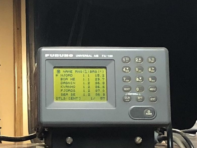
The Automatic Identification System (AIS) is a navigation system designed to accurately determine the position and other navigational statistics of ships. AIS operates using VHF radio channels, with transmitters and receivers enabling ships to send and receive messages.
This system assists the Officer on Watch (OoW) in enhancing navigational safety. However, AIS has its limitations, and the OoW must use all available navigation aids in conjunction with AIS.
AIS serves various tasks, including collision avoidance and traffic monitoring. According to International Maritime Organization (IMO) regulations, every passenger and commercial ship exceeding 299 gross tonnes engaged in international traffic must be equipped with an AIS Class A transponder.
Long Range Tracking And Identification (LRIT) System
The Long Range Tracking and Identification (LRIT) System is an international tracking and identification system implemented by the IMO under the SOLAS convention. It provides comprehensive tracking for ships over 300 gross tonnes on international voyages.
The LRIT system enhances maritime domain awareness by continuously monitoring and reporting the positions of ships. This information is crucial for improving the safety and security of maritime navigation.
Rudder Angle Indicator
The Rudder Angle Indicator displays the steering angle of the ship’s rudder. It is typically located on the bridge equipment console, enabling the navigator to control the steering angle and speed effectively.
Additional indicators are often found on the bridge wings and in the engine control room to provide consistent monitoring and control from multiple locations.
Voyage Data Recorder (VDR)
A Voyage Data Recorder (VDR) is a critical piece of ship equipment, often referred to as the “black box” of a vessel, similar to Flight Data Recorders in aircraft. The International Maritime Organization (IMO) mandates the use of VDRs for all vessels exceeding 3,000 gross tonnage.
The VDR collects, stores, and safeguards essential ship data related to its operation. This data includes information about the ship’s speed, position, heading, status of safety-related equipment, bridge audio, radar images, and navigational data. In the event of an incident, such as a collision, grounding, or other maritime accident, VDR data is invaluable for investigations to determine the causes.
The VDR consists of two main components:
- Data Collection Unit (DCU): Collects data from various sensors on the ship, tracking parameters like speed, direction, and engine performance.
- Protective Storage Unit (PSU): Also known as a “memory capsule,” this robust and waterproof unit stores the collected data. It is designed to withstand harsh conditions, including fire, pressure, and sea-water immersion. The PSU often includes an Underwater Locator Beacon to aid in its recovery if the ship sinks.
Modern VDRs often feature live data streaming capabilities, enabling shore-based teams to monitor the ship’s status and performance in real-time, potentially preventing incidents before they occur.
Rate Of Turn Indicator
A Rate of Turn Indicator (ROTI), also known simply as a Rate of Turn Indicator (ROT), is a device used on ships to measure and display the rate at which the ship is turning. It is typically installed on the bridge and is essential for navigating and maneuvering, particularly in restricted waters or near other vessels.
The ROT Indicator shows the rate of turn in degrees per minute. The standard scale is set at 30 degrees per minute to port or starboard, but it can also display higher rates of turn. This information helps the ship’s master or officer in charge make precise and safe navigational decisions.
In modern vessels, the rate of turn is often integrated into the navigation system, collecting data from various sensors, including gyrocompasses and GPS receivers. The rate of turn information is used alongside other navigational tools like autopilots, radar, and electronic chart systems.
According to IMO standards, all ships of 50,000 gross tonnage and above must be fitted with a rate of turn indicator. This regulation promotes safe navigation and reduces the risk of collision or grounding.
GPS Receiver
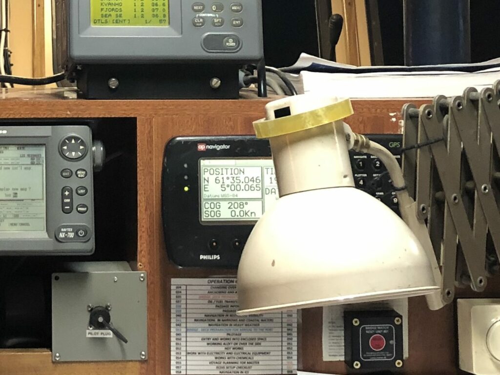
A Global Positioning System (GPS) receiver is a type of display system that uses global positioning satellites in Earth orbit to pinpoint the exact location of a ship.
By recording the ship’s position, the GPS receiver allows for the calculation of speed, course, and the estimated time needed to travel the distance between two marked positions.
Navigation lights are essential for all boats, regardless of size, as part of their navigation system. This requirement was introduced in 1838 by the United States and adopted by the United Kingdom in 1849.
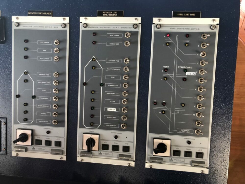
The United States later organized the International Maritime Conference in 1889 to establish guidelines for preventing maritime accidents. By 1897, these rules were globally accepted, making navigation lights one of the most critical navigational aids for sailing the seas.
Navigation lights enable ships to see and be seen by other vessels at night, ensuring safe passage and preventing collisions.
Transmitting Heading Device (THD)
A Transmitting Heading Device (THD) is an electronic device used to display information about the true heading of a ship. It provides accurate heading data, which is crucial for safe navigation and maneuvering.
For more detailed information about THDs, you can refer to Chapter 5 of the SOLAS (Safety of Life at Sea) Convention.
Summary
There are lots of different types of navigational equipment that can be found on board ships in maritime, but each of them will have its own specific purpose.
Whether that be determining a safe route, avoiding a collision, or determining position, there are different types of equipment that can tell you all of these things and so more than this.
- Types of Gas Carriers as per IGC Code – April 22, 2025
- Wind-Assisted Propulsion Systems (WAPS): A Game Changer for Maritime Decarbonization – February 6, 2025
- 10 Boat Salvage Yards in California – January 25, 2025

