You might have spotted the symbolic representation and alphabet regardless of their dimensions and location on different vessels. These ship hull markings may seem familiar to us, yet often, they go unnoticed or not completely understood.
These symbolic representations tell something specific about a certain region in a vessel as well as certain key aspects related to the vessel for those in the operational area must know.
Also, these symbols are mandatory as per laws put forward by the ship classification societies. Let us deepen our knowledge from the below sections.
What Are The Main Ship Hull Markings?
Some of the most seen markings on a vessel are either placed to represent a specific function or a means of safety standards. The main symbolic representation corresponds to the loading of the vessel which was used from the early days of maritime transportation.
Looking back into history, the Kingdom of Crete is credited with developing the first recognized marine loading standards in 2500 BC.
Different regions around the world had different rules, for example, considering only Italy as an example Roman maritime rules had their set of standards, Venice required a cross to be marked on a ship’s side during the Middle Ages, and Genoa needed three horizontal lines.
Some of the most found markings are the following,
- International load line marking
- Draft marking
- Bow thruster marking
- Tug/no tug marking
- Pilot boarding marking
Let us look into each of these kinds of markings.
International Load Line Marking
The Plimsoll Lines or International Load Lines are probably the symbols that are the most significant and commonly found on all the vessels. The circle with a horizontal line through it is the original Plimsoll Line.
Plimsoll Line was created in 1876 by Samuel Plimsoll, a member of the British Parliament, after the loss of a vessel and her crew as a result of deliberate cargo overloading by dishonest merchants who over-insured their vessels and then preferred to see them complete her mission.
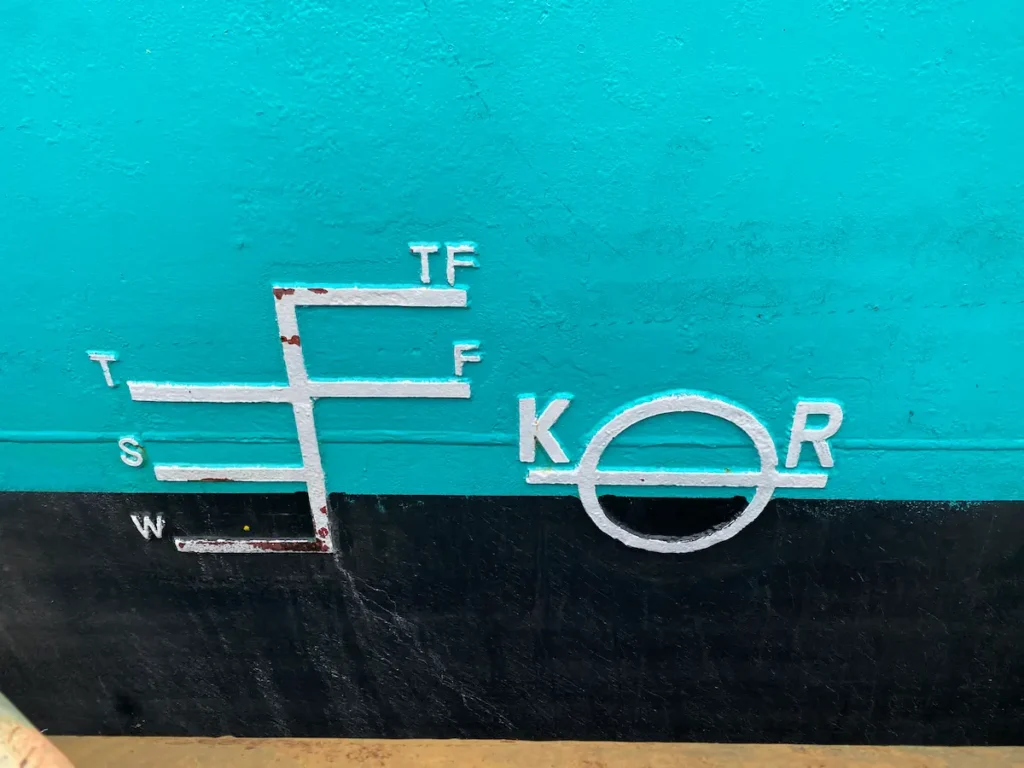
The International Load Line markings are found close to the center of the hull and indicate how far below the waterline a ship’s draft (the distance between the waterline and the bottom of the hull) may be governed by a variety of conditions, including fluctuations in water temperature and density.
Let us consider a large container ship that is being loaded while it is in port. The ship sinks further into the ocean as the weight and number of cargos increases. The ship would be at serious risk of sinking if the freeboard—the gap between the waterline and the top of the hull—became too small.
The following is a graphical representation of a typical load line marking.
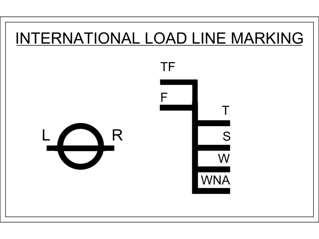
The ship’s registration authority, in this case, the Lloyd’s Register of Marine Shipping, is indicated by the letters “LR” on either side of the Plimsoll Circle.
Draft Markings Or Draft Marks
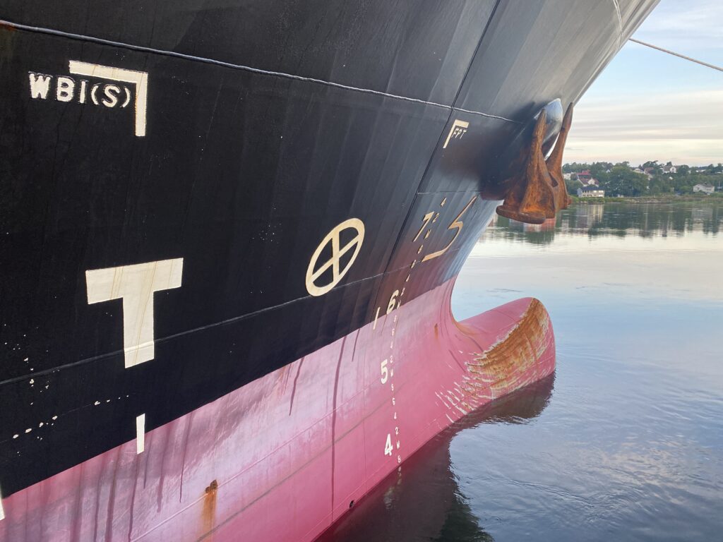
Draft markings are numbers placed in a vertical line towards the forward and aft of a vessel. They gauge the distance (draft) between the waterline and the lowest point on the ship’s hull, which fluctuates depending on cargo loading.
By comparing the waterline depths on the ship’s two sides, the number at the waterline may be used to determine the ship’s draft, if it is overloaded, unevenly loaded, and trimming heeling.
Bow Thruster Markings
The bow thruster markings are a circle with an “X” inside or propeller visualisation. It denotes a bow thruster located at that specific region, which helps a ship’s bow be moved laterally. When un/docking, this becomes helpful.
Similar to those seen at the bow, markings may also be seen at the stern of the hull. Instead of the conventional propellers on shafts and a rudder, many contemporary cruise ships use azimuth pods, hence they lack an aft thruster.
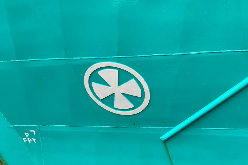
A vessel with bow thruster markings symbolizes the use of thrusters and the vessel will be using a conventional propeller and thruster system for maneuvering. To prevent harming both the ship and the tug, tugboat captains avoid both concealed bow thrusters and bulbous bows.
Bulbous Bow Marking
This marking represents that the ship has a bulbous bow, which is a bulging bulb at the front of a ship that may be wholly underwater when the ship is fully loaded, as shown by the symbol that resembles the number “3,” which is used to indicate this. A large value of resistance of a vessel is decreased by a bulbous bow by producing its wave, which partially cancels out the ship’s bow wave.
Tug/No Tug Markings
Other marks which include only alphabets may be seen around the center of the hull and are just as significant as those at the bow and rear.
Shell doors, also known as service access doors and hatches, are secured by marks like “No Tug,” as can be seen below on a Celebrity ship. Shell doors offer access to service ways for loading and unloading food, freight, and machinery.
Also, areas, where tugs are allowed to be in proximity of the vessel, are indicated with the help of an indication written as “Tugs”.
Pilot Boarding Marking
A white square shape with a yellow boundary indicates a specification location on the hull where pilot boats can pull up next to a moving vessel, where there is a specific entry point through which the pilot can board the vessel.
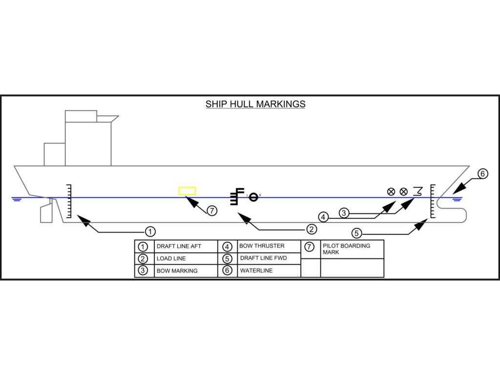
A general overview of all the markings is given in the diagrammatic representation below to make it much easier to visualize the same the next time you come across any vessel.
Why Is International Load Line Marking Relevant For Vessels?
Let us take a typical example, say a cargo vessel is plying in a temperate region, like England, the original Plimsoll Line functioned best while loading a ship in summer waters.
Today, the letter “S” stands for Summer. Later, additional letters were added to account for the various buoyancies of water in various climatic regions of the planet.
The ocean is indicated by the letter “T” for tropical sea water, “S” for summertime temperate, and “W” for wintertime temperate regions to the right of the vertical line.
The saltwater of the winter North Atlantic is indicated by “WNA” below “W.” For freight loading, a ship in “F” temperate fresh water, and “TF” tropical freshwater, use the letters to the left of the vertical line.
Looking into the properties of water, salt water is denser than freshwater, Warm water is less viscous than cold water, whether it is fresh or salty. Density has a direct relation to buoyancy. So, even though the winter North Atlantic Ocean’s salt water is the most buoyant, only the smallest quantity of cargo is loaded there, per these load lines.
Now you may wonder why this is done so. A freighter could indeed be loaded (illegally) with more goods and yet have enough freeboard if it only operated from Stockholm to London during the winter. However, Plimsoll lines account for the whole possible range of a freighter’s voyage, not simply the location at which it is loaded.
The hull of the ship will continue to sink as the ocean heats if it travels from London to Brazil, which is extremely close to the equator. An overloaded cargo may not have enough buoyancy or freeboard to protect against the risk of large waves when it eventually reaches the outflow of the river deltas, where freshwater can spread as far as 200 miles into the oceans.
No matter where else the freighter travels in the globe, it will not come across water that is less buoyant than where it is right now, hence at Brazil, the freighter may be loaded until the ship’s hull sinks to the “TF” tropical fresh water line.
The ships are inspected by classification societies, who then calculate their load lines. The Summer Load Line is the name of the common reference load line. The symbol for this is a horizontal line passing through a circle.
After taking into account water density and temperature, further lines show the limit. On the Summer Load Line, the letters next to each occurrence of the load line correspond to the classification society and varying load restrictions in different seas, such as for tropical or North Atlantic operations.
Ship Hull Marking Summary
Thousands of commercial ships travel across international seas, carrying billions of tons of cargo annually and handling more than 80% of global trade.
The best people to observe and comprehend these hull symbols are tugboat captains and other people who are personnel in ports or on the sea. Now that you know more about the symbols the next time you are near a vessel you can pay more attention to these details.
- Types of Gas Carriers as per IGC Code – April 22, 2025
- Wind-Assisted Propulsion Systems (WAPS): A Game Changer for Maritime Decarbonization – February 6, 2025
- 10 Boat Salvage Yards in California – January 25, 2025


